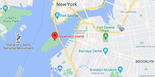
https://www.google.com/maps/place/Governors+Island
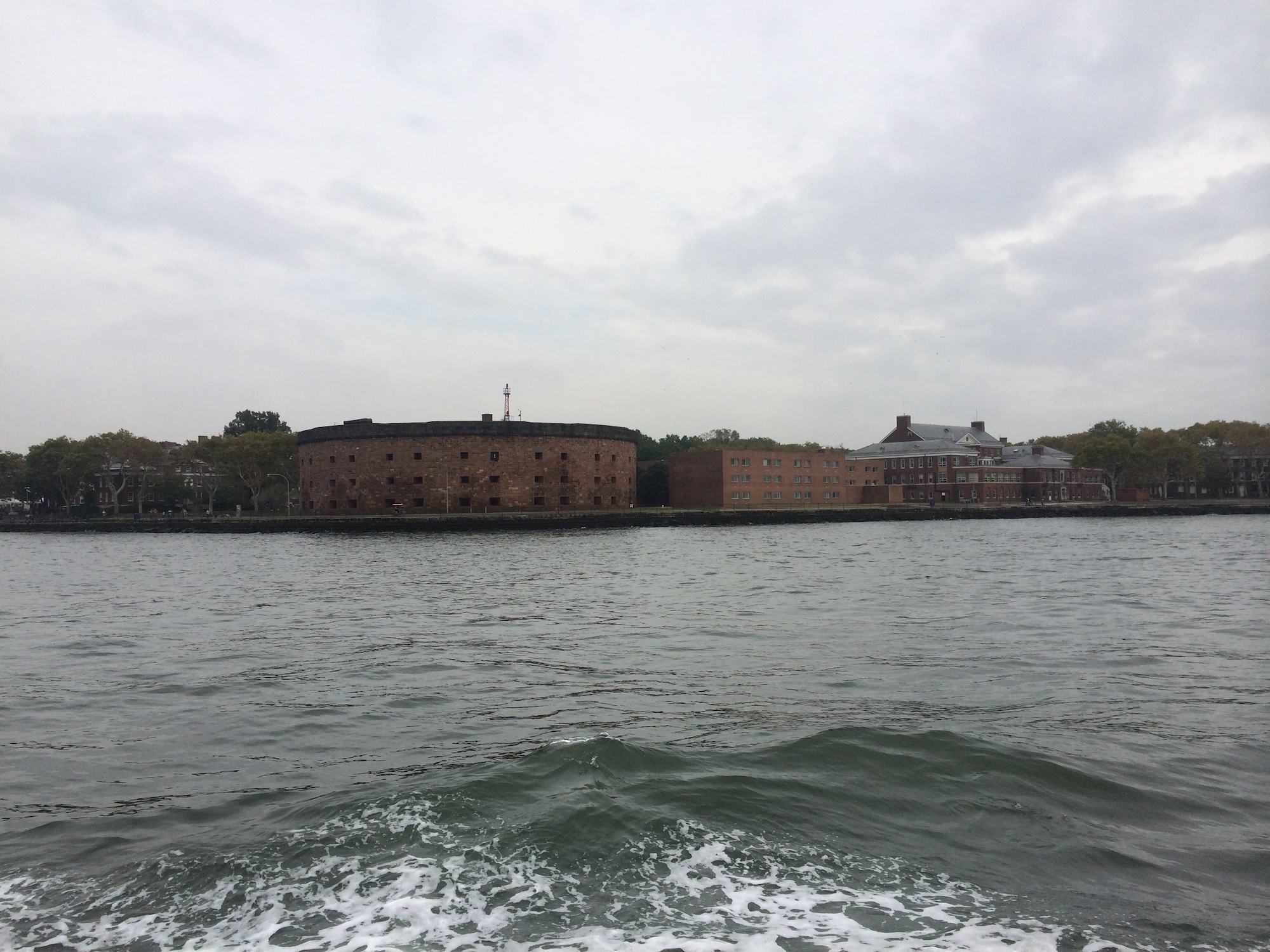
Castle Williams
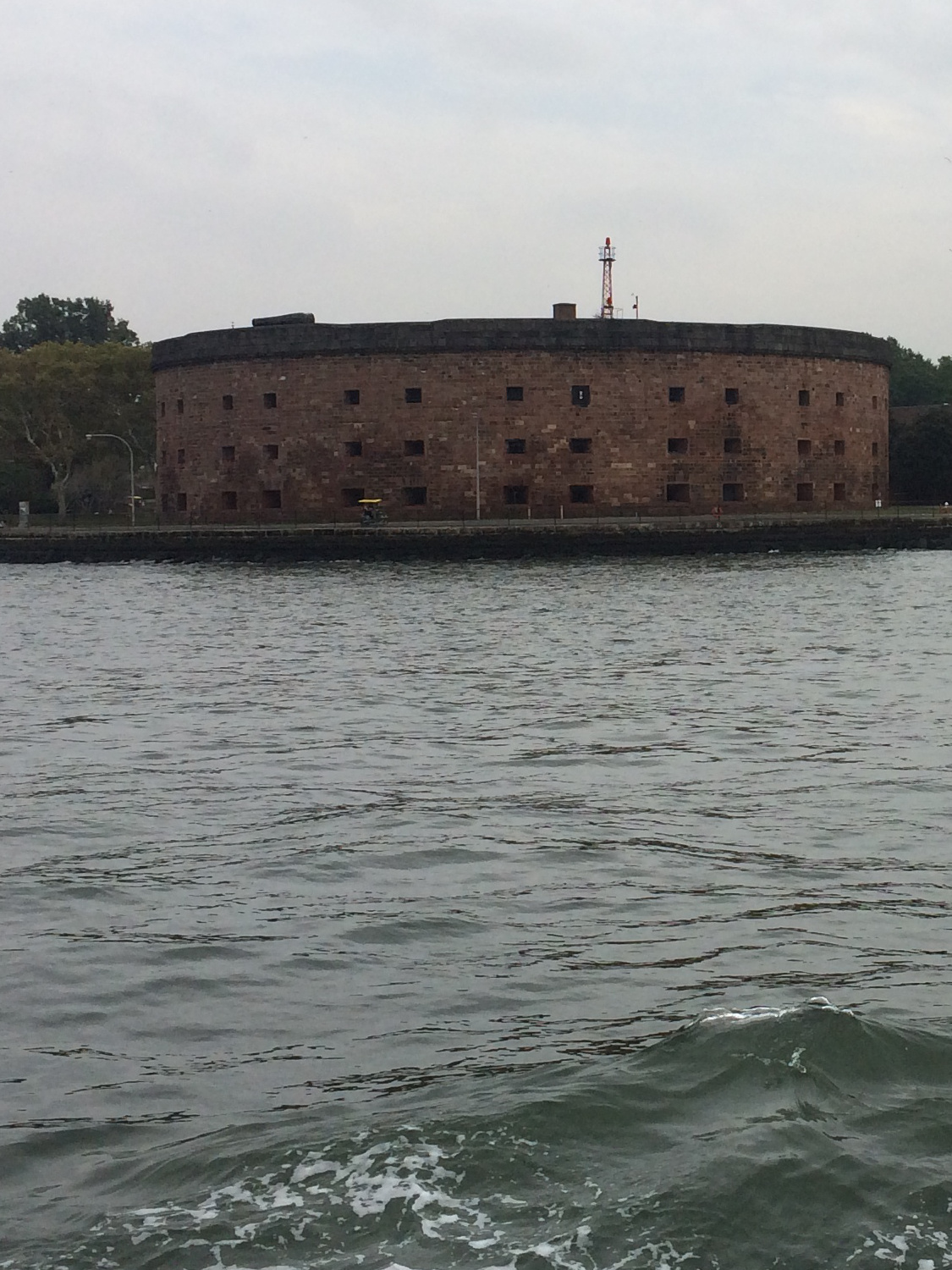
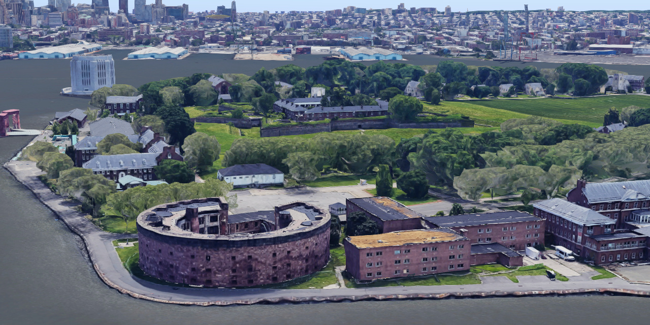
A circular defensive work of red sandstone on the west point of Governors Island in New York Harbor. It was erected between 1807 and 1811, designed by the Chief Engineer of the US Army Corps of Engineers, Lt. Col. Jonathan Williams, for whom the fort is named, and considered a prototype for new forms of coastal fortification.The castle was one component of a larger defensive system for the inner harbor that included Fort Jay and the South Battery on Governors Island, Castle Clinton at the tip of Manhattan, Fort Gibson at Ellis Island (then Oyster Island), and Fort Wood, which is now the base of Statue of Liberty on Liberty Island (then Bedloe's Island). This system of forts came to be known as the Second American System of coastal defense and existed to protect harbors like the one in New York from British interference with American shipping.
Its usefulness as a fort began to end in the 1830s, so Castle Williams subsequently served as barracks for the island's garrison and new and transient troops. Thereafter, the castle was remodeled by the US Army for use as a prison in various forms during the Civil War and through the first half of the 20th century.
- In 1901, Secretary of War Elihu Root, who worked hard to modernize the Army, also made a commitment to preserve the castle and overruled army leaders who wanted to demolish both it and Fort Jay.
- By 1903, the castle was fitted up as a model, state-of-the-art prison facility.
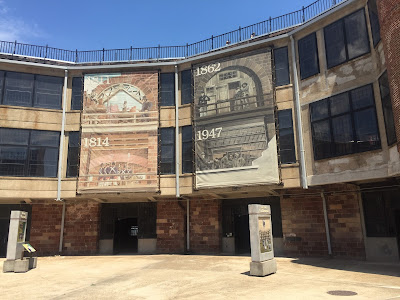
- In 1947, extensive renovations were carried out with the wooden catwalks replaced by concrete enclosed walk ways, hiding the beautiful stone arches on the third level and resulting in the industrial appearance of the courtyard today.
- Castle Williams ceased operations as a military prison in 1965 just before the U.S. Army left Governors Island.
The castle again faced a demolition challenge as Coast Guard officials in Washington, DC, who took control of Governors Island in 1966, wanted to demolish it. Instead, the castle was remodeled as a youth community center with a nursery, meeting rooms for Scouts and clubs, a woodworking shop, art studios, a photography laboratory, and a museum. By the late 1970s the community center moved to another location and the fort became the grounds-keeping shop for the Coast Guard base.
Over time, the roof failed and broken windows allowed serious water damage to occur inside the castle. In the mid-1990s, the roof was replaced and new windows stopped further water damage to the structure. The National Park Service stabilized and restored the castle and, when possible, provides access to the roof, allowing the public to admire the harbor and the modern skyline of the great city this fortress once protected.
https://www.nps.gov/gois/learn/historyculture/castle-williams.htm
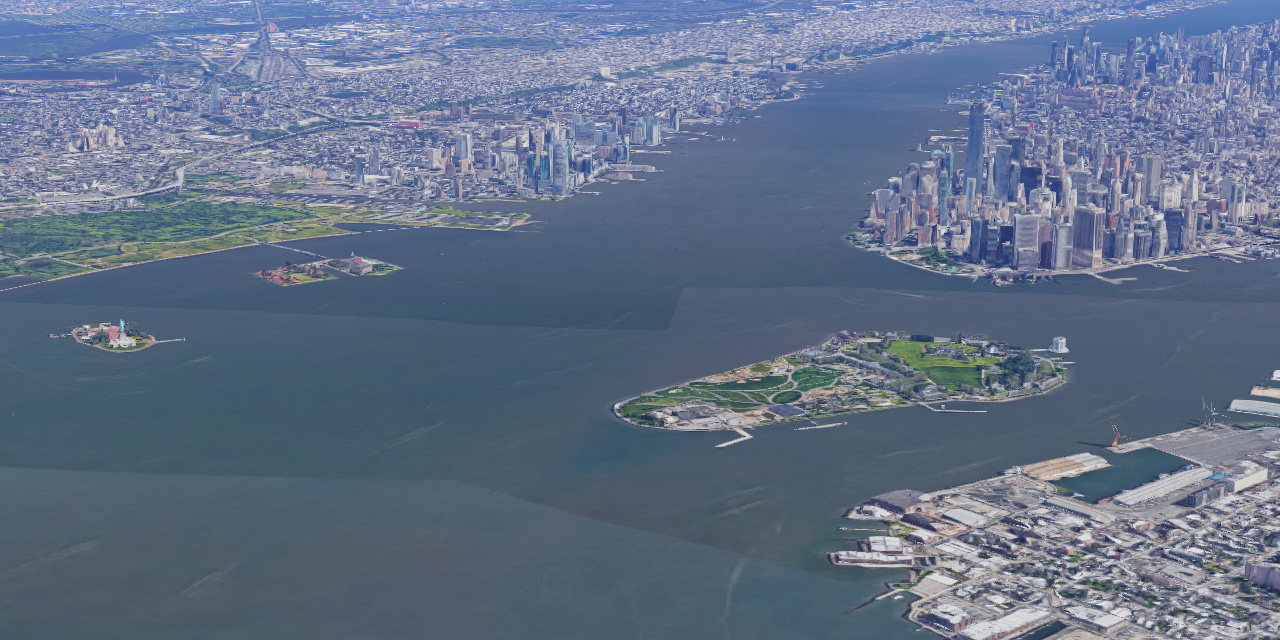
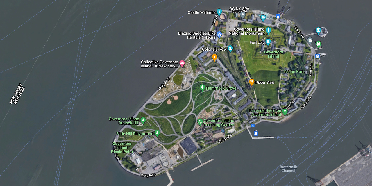
Manhattan upper right, Jersey upper left, Statue of Liberty and Ellis Island on left
https://www.google.com/maps/place/Governors+Island
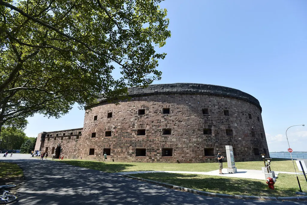
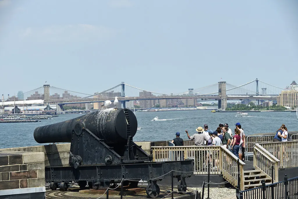
It inspired the design of countless forts across the country. You could shoot in every possible direction.
It could be seen as a testament to the castle's intimidating nature that it was never tested by the British, who avoided New York altogether in the War of 1812. The 100 cannons went unfired except for a half-day of target practice.
https://www.nytimes.com/2012/08/03/nyregion/touring-castle-williams-on-governors-island.html
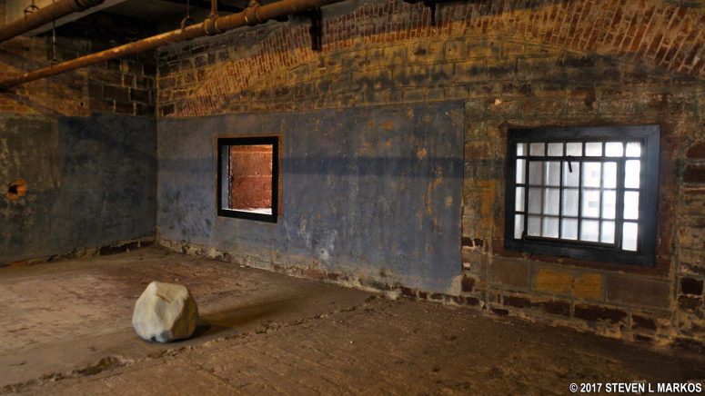
Each casemate has a window. These are called embrasures: opening from which cannon could fire. If fully armed, each window would have a cannon in front of it.
https://www.nytimes.com/2012/08/03/nyregion/touring-castle-williams-on-governors-island.html
 Castle Williams and The War of 1812:
Commonly called America's Second War of Independence, the War of 1812 was a major conflict with Great Britain in the early years of the nineteenth century.
Unlike the American Revolution, the causes of the War of 1812 are far more economically and politically motivated rather than idealistic.
Instead, the War of 1812 pitted the fledgling United States, barely twenty years old against Great Britain in a conflict that centered on the recognition of American commercial and political rights.
The United States was looking to take its place in the world and to do this, it had to convince Great Britain that it would no longer be bullied or intimidated by European influences.
After the American Revolution, the United States sought to insulate itself from European affairs and focus on building up the new nation. George Washington, in his Farewell Address, laid out this policy of American neutrality in European affairs:
The great rule of conduct for us, in regard to foreign nations, is in extending our commercial relations, to have with them as little political connection as possible. Europe has a set of primary interests, which to us have none, or a very remote relation. Hence she must be engaged in frequent controversies the causes of which are essentially foreign to our concerns. Hence, therefore, it must be unwise in us to implicate ourselves, by artificial ties, in the ordinary vicissitudes of her politics, or the ordinary combinations and collisions of her friendships or enmities. – George Washington, 1796
British and French expected American support:
However, this would prove to be impossible, as the French Revolution sent Europe into political upheavals.
Both the British and the French expected American support during the war and would not accept American neutrality in the matter.
Both sides attacked and impounded American shipping, trusting that the United States Navy was unable to respond effectively to this violation of American neutrality.
The British, confident that the American experiment in democracy was doomed to failure, continued to harass American merchantmen and impress American seamen, forcibly conscripting American sailors for service in the British Royal Navy.
Meanwhile, British agents in North America supported insurrections by Native American tribes against the United States government in the Old Northwest.
American alliance with the French started to unravel:
At the same time, the American alliance with the French, dating back to the Revolutionary War was beginning to unravel.
The first forts built in the United States, beginning in the 1790's, were designed and overseen by French military engineers.
However, with the French Revolution and the United States' neutral stance, the alliance was soon tossed aside.
This state of conflict between the new French Republic and the United States was a major impetus for American self-reliance.
The country could no longer rely on the French to build its forts so it became necessary to train engineers to build the next generation of coastal defense.
Lt. Col. Jonathan Williams:
A major player in this self reliance revolution was Lt. Col. Jonathan Williams, the commandant of the Army Corps of Engineers and the superintendent of the United States Military Academy at West Point.
Williams was a relative of Benjamin Franklin's and while Franklin spent the American Revolution in Paris negotiating the French alliance, Williams studied military engineering from the same engineers who would soon become America's enemies.
Full of these ideas, Williams was selected to improve American coastal fortifications in the years leading up to the War of 1812.
One of his major additions was the construction of Castle Williams on Governors Island.
With the other forts in New York Harbor, Castle Williams worked to defend the largest economic center in the new country from attack, an attack that almost came at the outbreak of the War of 1812 between Great Britain and the United States.
United States declare war on Great Britain:
After all the diplomatic issues with Great Britain, from preventing trade to impressing sailors, the United States declared war on Great Britain, thinking this would give the country a chance to attack and capture parts of Canada.
This plan did not work out well for the United States, however.
Its troops were often ill-disciplined militia with a very small core of regular, professional soldiers.
The British, on the other hand, had massive numbers of experienced troops from their wars in Europe against Napoleon.
Also, the Royal Navy was the most powerful Navy afloat after its stunning victory over the combined Spanish and French fleets at the Battle of Trafalgar.
Castle Williams Deterred the Royal Navy away from New York:
During this war, Castle Williams never had to fire a shot in anger.
Admiral Cochrane, the commander of British naval forces in the North American theater declined to attack New York Harbor because of the system of coastal defense in place.
During the American Revolution, the British were able to capture the major port of New York, a fact that spurred the construction of the coastal defense forts like Castle Williams in case of another attack.
The four story masonry fortress with its massed artillery batteries was a sufficient deterrent on its own, guarding the major approaches to Lower Manhattan by sea.
Instead, the Royal Navy landed General Ross and his British invasion force on the coast of Maryland.
This veteran British force swept aside pitiful American resistance and went on to burn Washington D.C. to the ground.
The War of 1812 was a stalemate in the final analysis:
Despite stunning American victories in single-ship actions at sea, like the fight between the USS Constitution and HMS Guerriere, and Andrew Jackson's defense of New Orleans, the United States had not won enough major battles to call for a favorable peace.
Instead, things were restored to the same state of affairs as before the war with the signing of the Treaty of Ghent between the United States and Great Britain.
Castle Williams, untested in combat, was no longer on a state of alert and slowly began to transition into another use for the US Army.
https://www.nps.gov/gois/learn/historyculture/castle-williams-and-the-war-of-1812.htm
https://www.google.com/maps/place/Castle+Williams
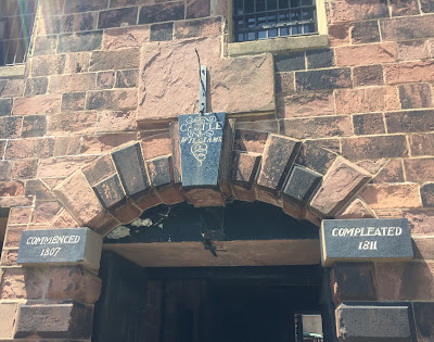
Its circular shape was highly innovative at the time, giving soldiers stationed at the fort's casements a wider field of range from which to defend New York Harbor.
http://www.secretvictorianist.com/2017/06/the-secret-victorianist-on-governors.html
http://www.secretvictorianist.com/2017/06/the-secret-victorianist-on-governors.html
Castle Williams is a circular fortification of red sandstone on the northwest point of Governors Island, part of a system of forts designed and constructed in the early 19th century to protect New York City from naval attack.Castle Williams:
- It was designed and erected between 1807 and 1811 under the direction of Lieutenant Colonel (later Colonel) Jonathan Williams, Chief Engineer of the Corps of Engineers.
Jonathan Williams became the first Superintendent of the United States Military Academy at West Point, New York and was also a relative of Benjamin Franklin.The castle was one component of a defensive system for the inner harbor that included:
- Fort Columbus (later renamed Fort Jay) and the South Battery on Governors Island
- Castle Garden (later renamed Castle Clinton) at the southern tip of Manhattan
- Fort Wood on Bedloe's Island (later renamed Liberty Island)
- Fort Gibson on Oyster Island (later renamed Ellis Island)
It established a prototype for American coastal fortification design for the rest of the 19th century.
- Its pioneering design consisted of multiple levels of enclosed or fortified gun emplacements (casemates).
- The nearly circular fortification, 40 feet high and 210 feet in diameter, was constructed of sandstone walls 7 to 8 feet thick.
- Each of its four levels had 13 casemates (or pairs of barbette mounts on the fort's roof) that could hold 26 cannons of varied caliber.
Before its completion, Colonel Henry Burbeck, commanding the defenses of New York City, issued an Army order on November 24, 1810, that named the castle for its designer and builder: "In future the Stone Tower on this Island (by the approbation of the Secretary of War) will bear the name of CASTLE WILLIAMS, in honor of the commandant of the United States Corps of Engineers, who designed and erected it."
Governors Island is a 172 acre island in New York Harbor, within the New York City borough of ManhattanGovernors Island:
- It is located approximately 800 yards (732 m) south of Manhattan Island
- It is separated from Brooklyn to the east by the 400-yard-wide Buttermilk Channel.
- The National Park Service administers a small portion of the north of the island as the Governors Island National Monument, including two former military fortifications named Fort Jay and Castle Williams.
- The Trust for Governors Island operates the remaining 150 acres, including 52 historic buildings, as a public park.
- About 103 acres of the land area is fill, added in the early 1900s to the south of the original island.
Noten Eylandt:
The native Lenape originally referred to Governors Island as Paggank ("nut island") because of the area's rich collection of Chestnut, Hickory, and Oak trees, and because it is believed that this space was originally used for seasonal foraging and hunting. The name was translated into the Dutch Noten Eylandt, then Anglicized into Nutten Island, before being renamed Governor's Island by the late 18th century.
- The island's use as a military installation dates to 1776, during the American Revolutionary War, when Continental Army troops raised defensive works on the island.
- From 1783 to 1966, the island was a United States Army post, serving mainly as a training ground for troops, though it also served as a strategic defense point during wartime.
- The island then served as a major United States Coast Guard installation until 1996.
- Following its decommissioning as a military base it was sold to the public for a nominal sum in 2003, and opened for public use in 2005.
Governors Island has become a popular destination for the public, attracting more than 800,000 visitors per year as of 2018. In addition to the 43-acre public park, Governors Island includes free arts and cultural events, as well as recreational activities. The New York Harbor School, a public high school with a maritime-focused curriculum, has been on the island since 2010. The island can only be accessed by ferries from Brooklyn and Manhattan.
| Governors Island | |
|---|---|
| https://www.govisland.com/history | |
| 1524 | The Lenape: The Native Americans of the Manhattan region, the Lenape, referred to what is now known as Governors Island as Paggank ("Nut Island") after its plentiful hickory, oak, and chestnut trees. The Island's location made a perfect fishing camp for local tribes, who used the Island seasonally. |
| 1624 | Early Dutch Colonies: The Dutch West India Company first arrived to New Amsterdam and opted to set up camp on the small, 70-acre Island rather than brave the wilderness that lay across the water on the island that would later be known as Manhattan. Adopting the Native American name, the Dutch settlers called the Island "Noten Eylandt." They constructed a fort and sawmill here. Many resettled on Manhattan Island the following year. |
| 1637 | Purchase of Noten Eylandt: In June 1637, Wouter Van Twiller, the director general for the Dutch West India Company, reportedly purchased the Island from the Lenape for "two ax heads, a string of beads, and a handful of nails." Though he was a representative of the Dutch West India Company, with a charter from the Dutch government, Van Twiller purchased the Island and several others in the Harbor for private use and real estate speculation. The Dutch government confiscated the Island a year later. |
| 1664 | The British come to the island: In 1664, the English captured New Amsterdam, renamed it New York, and took Nutten Island (the British mispronunciation of the Dutch name). The city and the Island switched hands between the British and the Dutch over the next decade until the British regained exclusive control of the Island for "his majesties fort and garrison." |
| 1699 | British Governor's Residence: The Island was renamed "Governors Island", and reserved for the "benefit and accommodation of His Majesty's Governors." |
| 1750 | Becoming part of New York: Governors Island was made part of the British territory of New York County under the Montgomerie Charter. The Charter was a typical method of colonial governance that expanded the city's powers under British rule. The Charter gave the city some judicial powers and control over the establishment of ferries, docks and construction of public buildings. |
| 1776 | The Beginning of the American Revolution: On June 7, 1775, just two months after the first major dissent in the colonies, the British were unable to continue occupying New York. British forces withdrew to Canada to replenish supplies and forces before attempting to retake the city, including Governors Island. |
| 1776 | Battle against the British: After the British withdrew from the Island, continental troops fortified the Island for fear of advances by the British Royal Navy. At the Battle of Brooklyn, the British Army overpowered General George Washington and his men, and American forces retreated from Long Island and Governors Island. The city and the Island were occupied by the British and used as their North American military headquarters for the rest of the American Revolution. |
| 1783 | British Withdrawal: At the end of the Revolutionary War, British troops withdrew from the city on November 25. This date would be celebrated as "Evacuation Day," a city holiday for the next century. The British Royal Navy departed the Island on December 4th, and the Royal Navy surrendered to the Continental Army. |
| 1794 - 1800 | Fortifying a New Republic: After the American Revolution, the state of New York inherited all lands owned by the British, including Governors Island. In 1794, with the country in need of a system of coastal defenses, the fledgling government began to fortify the Harbor, including construction of a fort, later to be named Fort Jay, on high ground in the center of the Island. In 1800, New York transferred the Island to the U.S. government for military use. |
| 1806 - 1812 | Fort Jay, Castle Williams, South Battery: Between 1806 and 1809, the U.S. Army reconstructed Fort Jay and renamed it Fort Columbus (in 1904, the name would be changed back to Fort Jay). Castle Williams, the second of three historical forts, was built on a rocky outcropping facing the harbor. In 1812, the South Battery, the third fort on the Island, was constructed. During the War of 1812, artillery and infantry troops were concentrated on Governors Island. The recently built fortifications deterred a British invasion, sparing New York the fiery fate that befell Washington, D.C. |
| 1861 - 1865 | Civil War: Governors Island continued to serve an important military function during the American Civil War, though it was no longer used primarily for physical defense of the Harbor. In the early years of the war, the Island was called into service as a recruitment depot and as a barracks for newly recruited soldiers |
| Confederate Prisoners of War: As the Civil War wore on, Fort Jay and Castle Williams were transformed into prisoner-of-war holding facilities for Confederate prisoners. Officers were imprisoned at Fort Jay, where lodgings were snug but comfortable, and they were allowed to stroll most of the Island at their leisure. Enlisted prisoners did not fare as well; the number of imprisoned rose to nearly 1,000 men, creating cramped, filthy conditions. | |
| 1878 | Army Headquarters: In the 1870s, the Army moved both offices and officers to the Island, building six new generals' houses, now known as Colonels Row, and enclosing Nolan Park. By 1878, Governors Island had evolved from a small military outpost to an army headquarters and garrison. The Island offered a quiet neighborhood not far from the hustle and bustle of the City for officers, enlisted men and their families. |
| 1912 | Island Expansion: Physically, the Island changed greatly during the early 20th century. Using rocks and dirt from the excavation of the Lexington Avenue Subway and dredge from New York Harbor, the Army Corps of Engineers supervised the deposit of 4,787,000 cubic yards of fill on the south side of Governors Island. This fill was used to add 103 acres of flat, treeless land, increasing the size of the Island to 172 acres by 1912. |
| 1917 | World War I: In the first act of the war by U.S. armed services, the 22nd Infantry Regiment stationed on Governors Island seized all German-owned cruise ships and ship terminals in the Hudson River in Manhattan and Hoboken. Within weeks, the ships would be used to transport most of the two million American soldiers to France to fight in the war. The 22nd Infantry stayed on the Island for the duration of the war, protecting the supply depot and vital infrastructure between New York City and Washington, D.C. |
| 1922 | Connection to the city: With the arrival of the 16th Infantry Regiment on Governors Island and Fort Jay in 1922, a strong connection was forged between the U.S. Army and the citizens of New York City. The regimental band marched in the city parades and had an Army camp at the 1939 World's Fair, while the public was invited to watch polo matches and mock battles staged on the Island. |
| 1941 | World War II: Between the two world wars, the Island served as an important headquarters for Army ground and air forces. By World War II, the U.S. First Army used it as its headquarters. Originally established in Europe in 1919, the First Army initiated their planning efforts for the D-Day invasion on Governors Island. The D-Day invasion led to the American landing in Normandy, and the liberation of Europe. |
| 1965 | The Army Departs: In the 1960s, U.S. Army continued to construct barracks and apartment buildings on the southern portion of the Island. The Island remained an army post and quiet neighborhood for military families until November 1964. In response to changing military technology and budget constraints, the U.S. Department of Defense announced the pending closure of Governors Island and the Brooklyn Navy Yard. |
| 1966 | Coast Guard Installation: In 1966, the Island was transferred to the United States Coast Guard. The Island became the Coast Guard's largest installation, with a self-contained residential community of approximately 3,000 and a commuting population of another 1500. Under the Coast Guard, the Island was the home of the Atlantic Area Command, the Maintenance and Logistics Command, and the Captain of the Port of New York. |
| 1986-1993 | A backdrop for History: Over the years, Governors Island served as the backdrop for a number of historic events. In 1986, the Island was the setting for the relighting of the newly refurbished Statue of Liberty by President Ronald Reagan. In 1988, President Reagan hosted a final meeting with Mikhail Gorbachev on Governors Island, and in 1993, the United Nations sponsored talks on the Island to help restore democratic rule in Haiti. |
| 1995 | Ending the Island's Military Role: As a cost cutting measure, the Coast Guard closed its facilities on Governors Island. All personnel were relocated by September 1996. It was the end of an era for the thousands of Coast Guard and Army families who had called the Island home. |
 https://www.nps.gov/gois/index.htm
https://www.govisland.com
10 South Street, Slip 7
New York, NY 10004
