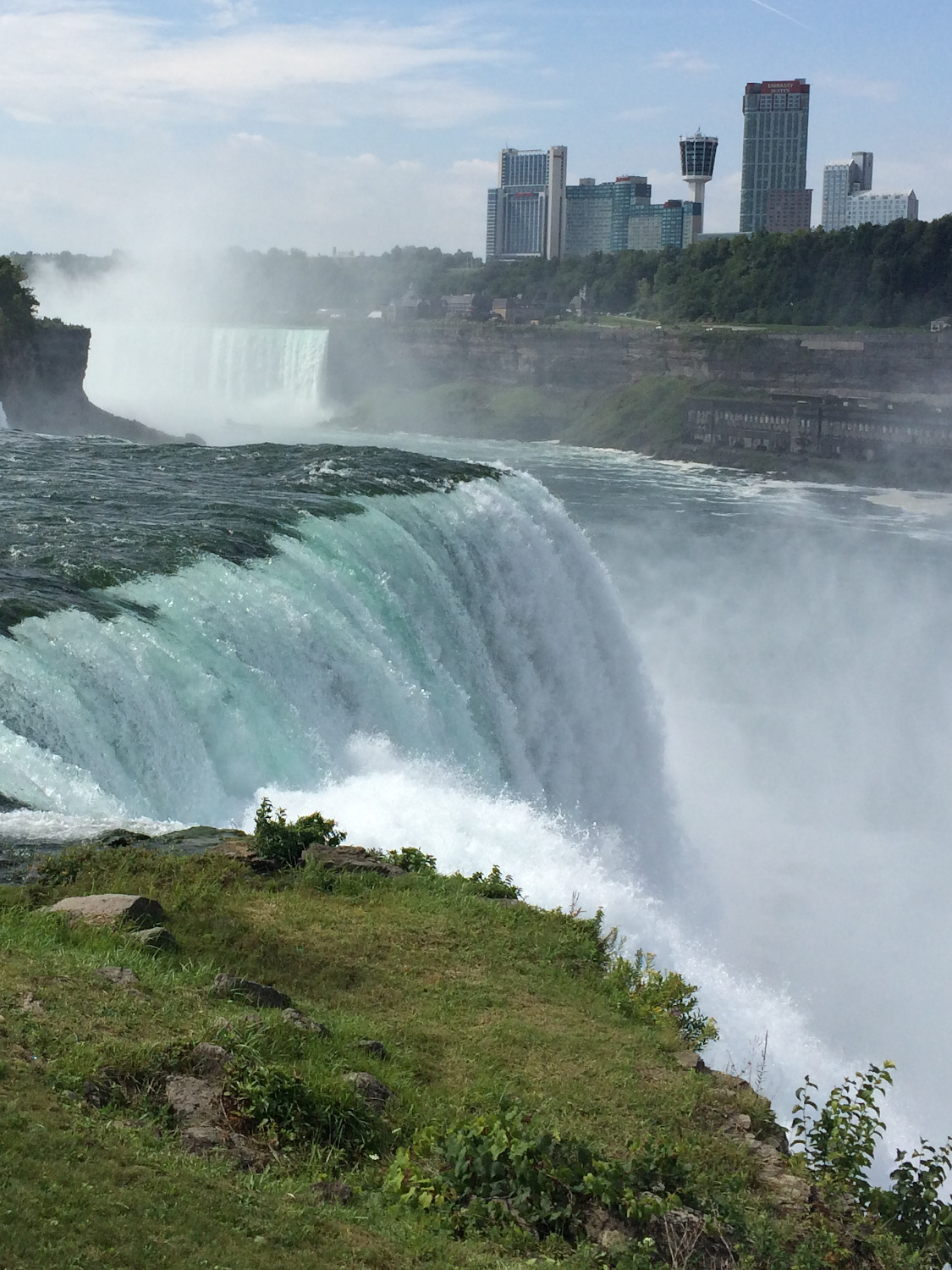
Trivia:Did you know that Niagara Falls is not the tallest waterfall in the world? There are about 500 other waterfalls in the world that are taller than Niagara. What makes Niagara Falls so impressive is the amount of water flowing over. Most of the tallest falls in the world have very little water flowing over them. It's the combination of height and volume that makes Niagara Falls so breathtaking.
Niagara Falls Top Ten:https://www.niagarafallstourism.com/niagara-region/city-of-niagara-falls/the-falls
- The word Niagara comes from the Iroquois word "onguiaahr" which means "the strait"
- Niagara Falls has moved back 7 miles in the last 12,000 years
- Niagara Falls is actually made up of three separate waterfalls: The American Falls, The Bridal Veil Falls (named for its resemblance to a bride's veil), and the Horseshoe Falls (the largest)
- The first person to survive a trip over Niagara Falls in a barrel was a 63-year-old schoolteacher. Seeking fame and fortune, Annie Taylor loaded herself - and her cat - up in a barrel and descended over the falls in 1901
- It is illegal to make an attempt to go over the Falls, and those who do so are fined $10,000
- The falls at Niagara are approximately 12,000 years old
- The Falls have only ever stopped once, in 1848, for 30 hours when ice fields from Lake Erie jammed at the source of the river
- More than 168,000 cubic metres or 6 million cubic feet of water go over the Horseshoe Falls every minute during peak daytime hours in the Summer
- Niagara Falls is the largest producer of electricity in New York State
- The crest line of the Canadian Horseshoe Falls is 2,200 feet wide
Why is the water so green?
The startling green color of the Niagara River is a visible tribute to the erosive power of water. An estimated 60 tons of dissolved minerals are swept over Niagara Falls every minute. The color comes from the dissolved salts and "rock flour," very finely ground rock, picked up primarily from the limestone bed but probably also from the shales and sandstones under the limestone cap at the falls.Niagara Falls Facts:
- More than 6 million cubic feet of water go over the crestline of the falls every minute during peak daytime hours.
- The Canadian Horseshoe Falls drops an average of 188 feet into the Lower Niagara River. The crest line of the Canadian Horseshoe Falls is approximately 2,200 feet wide. The plunge pool beneath the falls is 100 feet deep.
- The height of the American Falls ranges between 70-110 feet. This measurement is taken from the top of the falls to the top of the rock pile at the base, called the talus slope. The height of the falls from the top of the falls to the river is 188 feet. The crest line of the American Falls is approximately 850 feet wide.
- The rapids above the falls reach a maximum speed of 25 mph, with the fastest speeds occur at the falls themselves (recorded up to 68 mph.) The water through the Whirlpool Rapids below the falls reaches 30 mph, and at Devil's Hole Rapids 22 mph.
- The Niagara River is a connecting channel between two Great Lakes, Erie and Ontario.
- Niagara Falls has moved back seven miles in 12,500 years and may be the fastest moving waterfalls in the world.
- During the high season, the "tourist flow" over the falls of 100,000 cubic feet per second converts to 2,832 cubic meters per second, meaning 2,832 tonnes of water per second is flowing over the falls. The "non-tourist flow" is 1,416 tonnes of water per second flowing over the falls.
https://www.niagaraparks.com/visit-niagara-parks/plan-your-visit/niagara-falls-geology-facts-figures
Honeymoon Spot:
Theodosia Burr Alston (daughter of Vice President Aaron Burr) and her husband Joseph Alston were the first recorded couple to honeymoon there in 1801.
Niagara Falls State Park is the oldest state park in America, established in 1885 as the Niagara Reservation. Over 8 million visitors explore Niagara Falls State Park annually.Niagara Falls:
- The American and Bridal Veil Falls were turned off in 1969 by the U.S. Army Corps. of Engineers to study the effects of erosion.
There are plans to "turn off" the Falls again to rebuild two, 115-year-old bridges.
- Niagara Falls' current erosion rate is approximately 1 foot per year and could possibly be reduced to 1 foot per 10 years due to flow control and diversion for hydro-power generation.
- The water that flows over Niagara Falls is at 25-50% capacity at any given time.
Despite myths to the contrary, Niagara Falls does not freeze in the winter. However, the flow of water was reduced to a mere trickle for a few hours on March 29, 1848 because of an ice jam upstream in the Niagara River.
- Cave of the Winds, located at Niagara Falls State Park is torn down and re-built every year.
- Four of the five Great Lakes drain into the Niagara River, (Superior, Michigan, Huron and Erie) before emptying into Lake Ontario. These five Great Lakes make up almost one-fifth of the world's fresh water supply.
Fish travel over Niagara Falls and most survive because of their ability to flow with the water.
- Power generation facilities along the Niagara River supply more than one-quarter of all power used in New York State and Ontario. 50 to 75 percent of the water flowing along the Niagara River is diverted from going over the Falls to hydroelectric power generating stations.
https://www.niagarafallsusa.com/planning-tools/about-niagara-falls/fun-facts
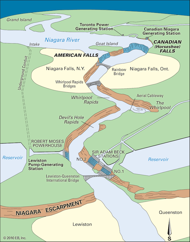
IMAGE: https://www.britannica.com/place/Niagara-Falls-waterfall-North-America
- Over Niagara Falls courses the outflow of four of the Great Lakes and 20% of the world's fresh water.
- With a vertical drop spanning more than 165 feet, Niagara Falls has the highest flow rate of any waterfall in world.
- Niagara Falls is the collective term for three waterfalls, located on the Niagara River which lays between United States and Canada:
- The American Falls
- The Horseshoe Falls
- The Bridal Veil Falls
Near the end of the last ice age, around 12,500 years ago, the Niagara River began to flow over a large cliff known as the Niagara Escarpment. The cliff is located at the northern end of the Niagara Gorge. It is here that Niagara Falls first formed. Over thousands of years the falls carved through the underlying rock, and as the falls receded due to erosion, it formed the 6.8 mile gorge that we see today.
The Niagara Gorge:
- Stretching about 6.8 miles, the southern end of the Niagara Gorge is Niagara Falls while the northern end is the Niagara Escarpment.
- Layers of rock forming the walls of the gorge are dated to be 440 million years old.
- Throughout the gorge, the mighty Niagara River tosses and turns from rapids to whirlpools, giving it the title as one of the most powerful river currents in the world.
- The origin of the Niagara River is at the north-east end of Lake Erie. From there, it flows north to its mouth at Lake Ontario.
- About 35 miles in length, the Niagara River features several islands, rapids, whirlpools and Niagara Falls in its course.
Historically, the Niagara River served as the gateway to the west with Native Americans and early European explorers portaging around Niagara Falls to travel to the interior of the North America. It was a core part of the extensive trade route that brought fur pelts from America's interior to Europe via the Great Lakes and the Saint Lawrence River.
- In the early 19th century, the Niagara River and its tributaries formed the last part of the Erie Canal increasing commerce and making Niagara Falls accessible for millions of visitors.
- The Niagara River was one of the final destinations on the Underground Railroad before freedom seekers entered Canada.
- By the mid to late 19th century, advances in engineering led to multiple bridges spanning the Niagara River.
- In the late 1880's, advances in science changed humankind when the Niagara River became the first waterway in North America to be harnessed for large-scale generation of hydroelectricity.
- Formed 450 million years ago from layers of sand, silt and clay, the Niagara Escarpment is an extensive landform visible as a line of steep slopes and long bluffs extending from New York State through Ontario, Michigan, Wisconsin and Illinois.
The Niagara Gorge is the channel cut through the escarpment by the Niagara River over time, and Niagara Falls is the present location of that erosive action.
-
The Great Lakes:
- The Great Lakes are the largest freshwater lakes in the world containing 20% of the world's fresh water.
- Spanning across northeastern North America, they consist of:
- Lake Superior
- Lake Michigan
- Lake Huron
- Lake Erie
- Lake Ontario
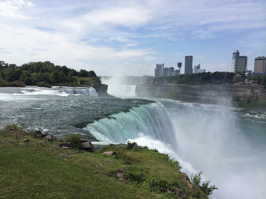
Niagara Falls was formed when glaciers receded at the end the last ice age, and water from the newly formed Great Lakes carved a path over and through the Niagara Escarpment en route to the Atlantic Ocean.Water Diversion:
Since the flow is a direct function of the Lake Erie water elevation, it typically peaks in late spring or early summer. During the summer months, at least 99,000 cubic feet per second of water traverse the falls, some 90% of which goes over Horseshoe Falls, while the balance is diverted to hydroelectric facilities and then on to American Falls and Bridal Veil Falls. This is accomplished by employing a weir - the International Control Dam - with movable gates upstream from Horseshoe Falls. The water flow is halved at night and during the low tourist season in the winter attains a minimum flow of 49,000 cubic feet per second. Water diversion is regulated by the 1950 Niagara Treaty and is administered by the International Niagara Board of Control.Green Water:
The verdant green color of the water flowing over Niagara Falls is a byproduct of the estimated 60 tonnes/minute of dissolved salts and rock flour (very finely ground rock) generated by the erosive force of the Niagara River.Geology:
The features that became Niagara Falls were created by the Wisconsin glaciation about 10,000 years ago. The retreat of the ice sheet left behind a large amount of meltwater (see Lake Algonquin, Lake Chicago, Glacial Lake Iroquois, and Champlain Sea) that filled up the basins that the glaciers had carved, thus creating the Great Lakes as we know them today. Scientists posit there is an old valley, Saint David's Buried Gorge, buried by glacial drift, at the approximate location of the present Welland Canal.When the ice melted, the upper Great Lakes emptied into the Niagara River, which followed the rearranged topography across the Niagara Escarpment. In time, the river cut a gorge through the north-facing cliff.
Because of the interactions of three major rock formations, the rocky bed did not erode evenly.All three formations were laid down in an ancient sea, their differences of character deriving from changing conditions within that sea.
- The caprock formation is composed of hard, erosion-resistant limestone and dolomite of the Lockport Formation. That hard layer of stone eroded more slowly than the underlying materials.
- Immediately below the caprock lies the weaker, softer, sloping Rochester Formation. This formation is composed mainly of shale, though it has some thin limestone layers. It also contains ancient fossils. In time, the river eroded the soft layer that supported the hard layers, undercutting the hard caprock, which gave way in great chunks. This process repeated countless times, eventually carving out the falls.
- Submerged in the river in the lower valley, hidden from view, is the Queenston Formation, which is composed of shales and fine sandstones.
Goat Island:
Just upstream from the falls' current location, Goat Island splits the course of the Niagara River, resulting in the separation of Horseshoe Falls to the west from the American and Bridal Veil Falls to the east.Named after the Niagagarega people:
Theories differ as to the origin of the name of the falls, one is that Niagara is derived from the name given to a branch of the local native Neutral Confederacy, who are described as the Niagagarega people on several late-17th-century French maps of the area.
Great Gorge Route:
There used to be a trolley service from Niagara Falls New York to Youngstown New York which followed the Niagara River right at the waters edge? It was named the "Great Gorge Route" and operated from 1895 until 1930. The owners of the line eventually closed for good due to the Great Depression and the newer and more modern modes of transportation of the bus and automobile. During the tourism season a flood light was mounted on a flat-bed car and used to illuminate the Giant Whirlpool at night. Portions of the old rail line are now part of the "Great Gorge Hiking Trail".
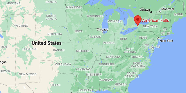
https://www.google.com/maps/place/Niagara+Falls,+NY
